Our Products
Engineered FOR ACCURACY
Built for Greatness
At Valhalla Instruments, we empower professionals with precision tools that deliver unmatched accuracy and reliability. As an authorized reseller of Tersus solutions, we bring you the cutting-edge technology needed to tackle any surveying, construction, or engineering project with confidence and precision.
Dedicated to your success, our name is inspired by the legendary strength and resilience of Viking culture. However, our focus is on providing state-of-the-art solutions that ensure your work stands the test of time. Explore our selection of Tersus solutions and equip yourself for success in every environment.
Contact us today to learn more and find the right solutions for your projects.

What's Your Application?
GNSS Equipment
OSCAR TREK GNSS RECEIVER
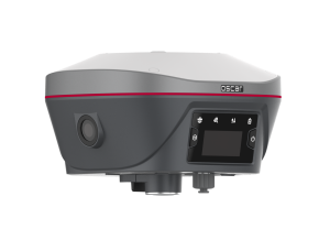
Features:
The Oscar Trek includes a camera for Visual Positioning to extract points from photos in the field.
Supports multiple constellations and frequencies
Supports 576 channels
Innovative visual positioning technology for precise measurements
410-470MHz UHF radio, 4G network, Wi-Fi, Bluetooth, NFC
Tilt compensation without calibration, immune to magnetic disturbances
OSCAR ULTIMATE GNSS RECEIVER
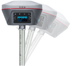
Features:
The Oscar Ultimate is where peak performance meets flexibility.
Supports multiple constellations and frequencies
Supports 576 channels
410-470MHz UHF radio, 4G network, Wi-Fi, Bluetooth, NFC
Tilt compensation without calibration, immune to magnetic disturbances
LUKA GNSS RECEIVER
Features:
Luka Ultimate is our palm-sized full-featured receiver with tilt compensation.
Supports multiple constellations and frequencies
Supports 1568 channels
Internal battery with slim body profile
Tilt compensation without calibration, immune to magnetic disturbances
TAP REAL-TIME CORRECTIONS

Features:
Centimeter-level accuracy, 1.5cm horizontally and 3cm vertically.
Rapid Convergence, less than 3 minutes from turning on the GNSS Receiver.
Global Coverage, Offer the freedom to work anywhere with at least 2 satellites covered.
99.99% Availability, The redundant system architectures of global reference stations, network control centers, and satellite uplink and downlink contribute to superior service available anytime.
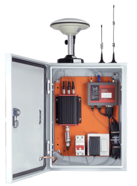
GEOBEE
Features:
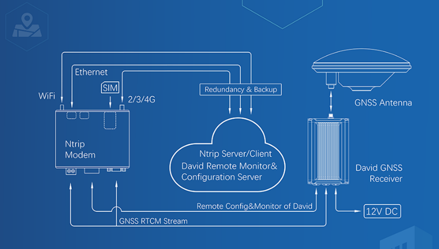
The Tersus GeoBee is an affordable permanent reference station, for transmitting or receiving NTRIP corrections. When combined with Tersus NTRIP Caster Service, NTRIP Modem, and David30 GNSS Receiver, the GeoBee enables users to easily send Real Time Kinematic (RTK) corrections via Ethernet, 2G/3G/4G connections using just a SIM card, or Ethernet cable, without requiring a static IP. The NTRIP caster service supports multiple bases simultaneously.
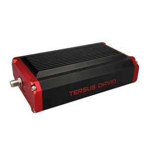
DAVID30 GNSS RECEIVER
Features:
The David is a modular GNSS receiver that is built for flexibility and high performance across various industries.
Supports multi-constellation including BeiDou, GPS, GLONASS, Galileo, QZSS and SBAS
Supports 576 channels
Supports RTCM2.x/3.x, CMR/CMR+ corrections
Flexible for integration in different applications
Input power range is 5~28V DC —Note: Input of 28~36V DC can be customized.
Supports Nuwa surveying software
Data Collecting Equipment
TC80
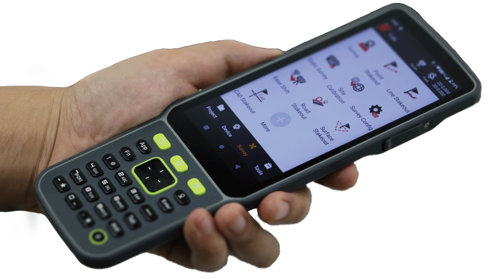
TC40
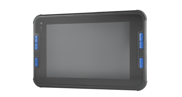
Features:
Opt for the robust TC80 5.5-inch data controller or the 8-inch TC40 rugged tablet controller as the core of your field data collection system. The TC80 is an ultra-lightweight, ergonomic handheld device designed for one-handed use. Meanwhile, the TC40, with its rugged Android tablet design, features a larger, high-resolution screen and offers cell phone capabilities.
NUWA SOFTWARE
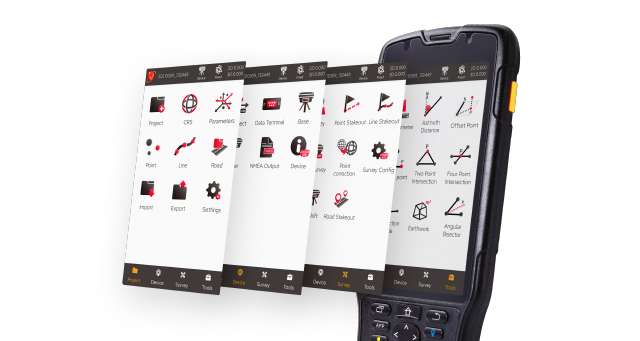
Features:
Nuwa is a field survey app designed for Tersus controllers or other Android devices (compatible with versions 6, 7 and later) that works seamlessly with Tersus Smart GNSS receivers. It features a graphical interface with a background map for CAD stakeout, road stakeout, Earthwork, tilt survey, and COGO tools for area perimeter, azimuth distance, and grid to ground calculations.
LiDAR Equipment
MVP S2
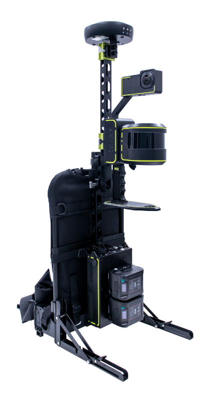
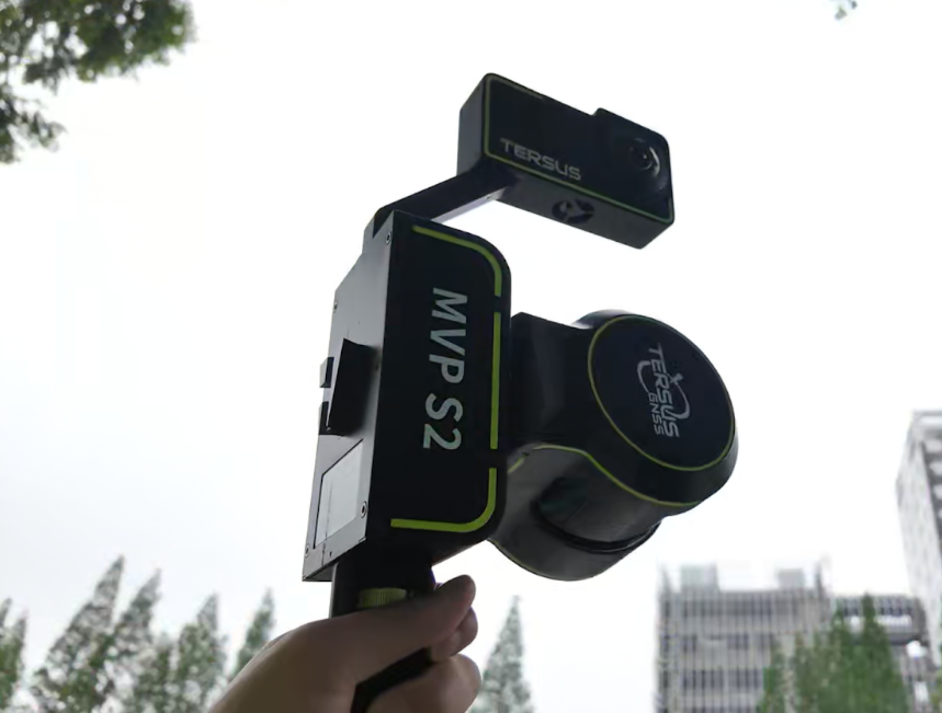
Features:
The Tersus MVP S2 is a professional-grade mobile 3D SLAM scanner that delivers sub-3 cm absolute accuracy using advanced RTK-SLAM technology. Whether handheld or worn as a backpack, it captures repeatable, high-resolution point clouds in real time, even in GNSS-denied environments.
The system includes a high-precision LiDAR, panoramic camera with a 1-inch Sony sensor and Leica lens, dual hot-swappable batteries (up to 3 hours of uninterrupted data collection per set), and full processing software.
TERSUS METAVERSE PAINTER (MVP)
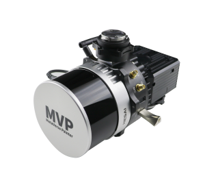
Features:
Advanced GNSS RTK system and built-in IMU supported
Multi-source data automatic alignment & fusion
5mm (PPK), 10mm (RTK) position accuracy
3-5cm point cloud accuracy
Multiple payloads, Drone, Vehicle supported
Powerful one-click processing software
Bathymetry Equipment
TheDuck
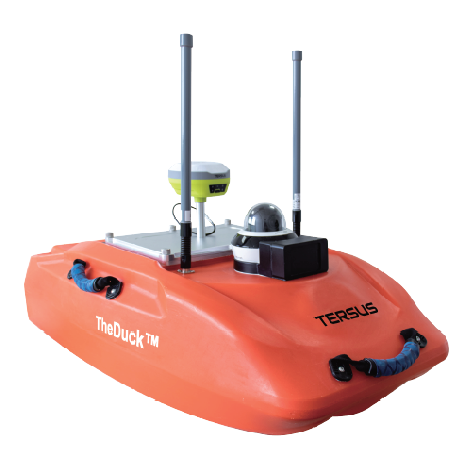
Features:
TheDuck is a high performance autonomous sonar boat.
Android/Windows operating system
Manual or Auto-Pilot navigation
Portable echo sounder: Automatically record data without PC & Retain original analog signal
Integrated communication system
RTK/PPP centimeter-level positioning
Remote control: Real-time display & Control distance up to 2KM
Request Information
Not sure what would work best for your project? Know what equipment you need? Get in touch with us to receive a quote or to request a demo.


Copyrights 2025 | Valhalla Instruments | Privacy Policy
Website created by the team at Desert Creative Group